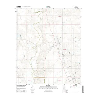
2015 Map of Cotton Valley
USGS Topo · Published 2015About this map
Cotton Valley serves as the primary hub for this portion of northwestern Louisiana, where the landscape is defined by the winding course of Bodcau Creek and the surrounding marshy lowlands of the Bossier and Webster Parish line. The map reveals a dense network of local roads and small settlements that speak to the area’s agricultural and residential development, including Dayson, Treat, and Couchwood. The topography is relatively gentle, characterized by numerous small tributaries like French Creek and Gray Cr that feed into the larger creek system. Genealogists and local researchers will find significant value in the distribution of family-named landmarks and burial sites across the quadrangle. Several small cemeteries, such as Flaherty Cem, Hodges Cem, and Sandin Cem, are preserved here, often located near the intersections of old parish routes like Parish Road 270 and Old Highway 7.
Find a feature on this map
82 named features on this map. Tap any name to fly to it.
Don’t see what you’re looking for? This feature index may not catch every label — zoom into the map to look around manually.
Map Details
Editions of this 2015 Cotton Valley Map
This is the sole edition of this map. No revisions or reprints were ever made.
Other maps of this area

1922 · Sarepta
USGS Topo · 1:62,500

1924 · Sarepta
USGS Topo · 1:62,500

1932 · Bossier NE
USGS Topo · 1:31,680

1947 · Minden
USGS Topo · 1:62,500

1948 · Bossier City
USGS Topo · 1:62,500

1949 · Minden
USGS Topo · 1:62,500

1950 · Plain Dealing NE
USGS Topo · 1:31,680

1950 · Plain Dealing SE
USGS Topo · 1:31,680

1953 · Carterville
USGS Topo · 1:24,000

1955 · Shreveport
USGS Topo · 1:250,000