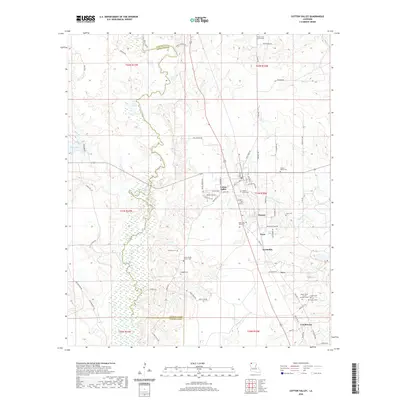
2020 Map of Cotton Valley
USGS Topo · Published 2020About this map
Cotton Valley serves as the central hub of this north Louisiana landscape, situated along the boundary of Webster Parish and Bossier Parish. The geography is defined by the winding course of Bodcau Creek and its associated wetlands, which separate the more developed eastern half from the western reaches near Ivan Lake. Genealogists will find a high concentration of burial sites and rural congregations, such as Mount Sariah Church Cem and Wesley Grove Cem, which anchor the small crossroads communities that once dotted the region.
Find a feature on this map
82 named features on this map. Tap any name to fly to it.
Don’t see what you’re looking for? This feature index may not catch every label — zoom into the map to look around manually.
Map Details
Editions of this 2020 Cotton Valley Map
This is the sole edition of this map. No revisions or reprints were ever made.
Other maps of this area

1922 · Sarepta
USGS Topo · 1:62,500

1924 · Sarepta
USGS Topo · 1:62,500

1932 · Bossier NE
USGS Topo · 1:31,680

1947 · Minden
USGS Topo · 1:62,500

1948 · Bossier City
USGS Topo · 1:62,500

1949 · Minden
USGS Topo · 1:62,500

1950 · Plain Dealing NE
USGS Topo · 1:31,680

1950 · Plain Dealing SE
USGS Topo · 1:31,680

1953 · Carterville
USGS Topo · 1:24,000

1955 · Shreveport
USGS Topo · 1:250,000