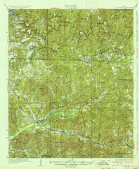
1934 Map of Cottondale
USGS Topo · Published 1934About this map
Cottondale and the eastern outskirts of Tuscaloosa County are defined here by a dense network of ridges and river valleys before the mid-century expansion of the regional infrastructure. The Black Warrior River cuts through the northwest corner, while the Southern RR and Mobile and Ohio RR provide the primary transport corridors for small rail-stop communities like Coaling and Duncanville. This landscape is heavily punctuated by local spiritual and educational landmarks, reflecting a decentralized rural society.
Find a feature on this map
76 named features on this map. Tap any name to fly to it.
Don’t see what you’re looking for? This feature index may not catch every label — zoom into the map to look around manually.
Map Details
Editions of this 1934 Cottondale Map
3 editions found

Other maps of this area

1899 · Brookwood
USGS Topo · 1:125,000

1924 · Tuscaloosa
USGS Topo · 1:62,500

1926 · Samantha
USGS Topo · 1:48,000

1926 · Tuscaloosa
USGS Topo · 1:62,500

1927 · Adger
USGS Topo · 1:48,000

1928 · Samantha
USGS Topo · 1:62,500

1929 · Searles
USGS Topo · 1:48,000

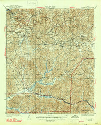
1931 · Cottondale
USGS Topo · 1:48,000

1932 · Yolande
USGS Topo · 1:62,500

1934 · Searles
USGS Topo · 1:62,500