Loading...
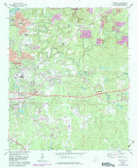
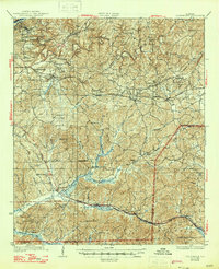
Loading map...1969 Map of Cottondale
USGS Topo · Published 1983About this map
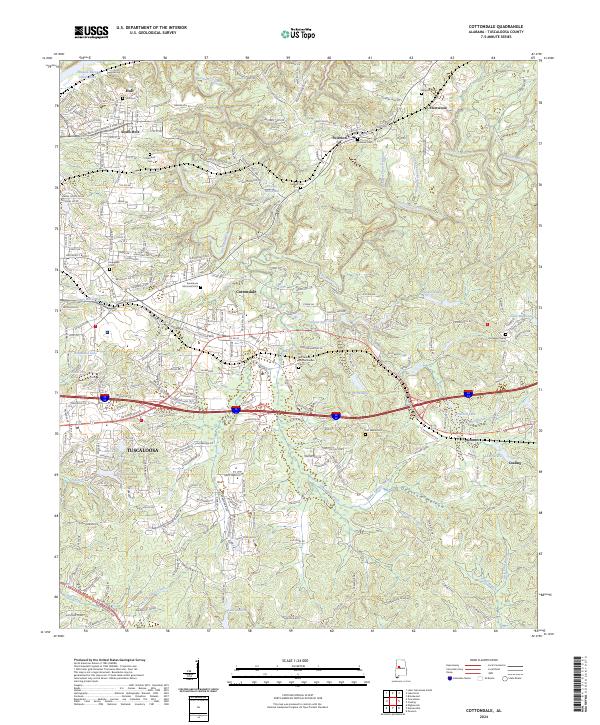
Black Warrior R flows along the northwestern boundary of this Alabama landscape, where the industrial and educational expansion of Tuscaloosa meets the coal-rich outskirts of Cottondale. The map reveals a complex land use pattern, from the expansive grounds of the U S Veterans Hospital and Tuscaloosa Memorial Park (Cemetery) to the extensive Strip Mines north of Peterson. This era captures the region's transport evolution, showing the Southern and Seaboard rail lines alongside newly developed highway interchanges.
Find a feature on this map
51 named features on this map. Tap any name to fly to it.
Don’t see what you’re looking for? This feature index may not catch every label — zoom into the map to look around manually.
Map Details
Date Portrayed1969
Date Published1983
PublisherU.S. Geological Survey
Map TypeTopographic
Scale1:24,000
Physical Dimensions22 x 26.9 inches
Editions of this 1969 Cottondale Map
Historical Maps of Tuscaloosa Through Time
8 maps found
Featured Locations
Source Details
SourceU.S. Geological Survey
CopyrightPublic Domain