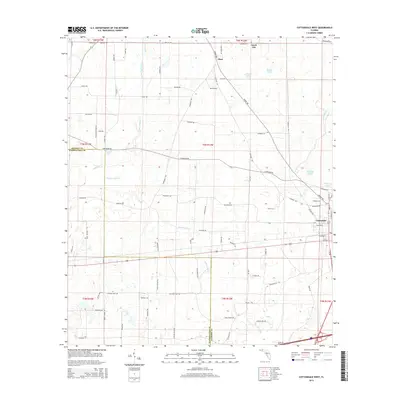
2015 Map of Cottondale West
USGS Topo · Published 2015About this map
Cottondale and Jacob City anchor this Northwest Florida landscape, situated within the agricultural and wooded corridor of Jackson County. The area is defined by an intricate network of water bodies and named drainage systems, most notably Gilberts Mill Cr and the winding Little Alligator Cr. These waterways, along with Russ Mill Cr and Dorman Br, once provided the essential resources for early settlement and local milling operations. A cluster of water features, including Bonnet Pond, Grassy Pond, Harold Pond, and Jackson Pond, are scattered across the terrain, reflecting the region's typical karst-influenced hydrology. A dense grid of local roads, such as Peanut Rd, Tobacco Rd, and Veteran Rd, cross the landscape, illustrating the enduring agricultural identity of the communities near the Jackson and Washington County line.
Find a feature on this map
86 named features on this map. Tap any name to fly to it.
Don’t see what you’re looking for? This feature index may not catch every label — zoom into the map to look around manually.
Map Details
Editions of this 2015 Cottondale West Map
This is the sole edition of this map. No revisions or reprints were ever made.
Other maps of this area

1950 · Chipley
USGS Topo · 1:24,000

1950 · Wausau
USGS Topo · 1:24,000

1951 · Graceville
USGS Topo · 1:24,000

1951 · Chipley
USGS Topo · 1:24,000

1951 · Wausau
USGS Topo · 1:24,000

1952 · Kynesville
USGS Topo · 1:24,000

1952 · Cottondale East
USGS Topo · 1:24,000

1952 · Campbellton
USGS Topo · 1:24,000

1952 · Cottondale West
USGS Topo · 1:24,000

1952 · Sills
USGS Topo · 1:24,000