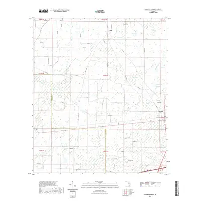
2021 Map of Cottondale West
USGS Topo · Published 2021About this map
Cottondale anchors the southeastern corner of this Jackson County landscape, where the local road network fans out into a patchwork of rural homesteads and wetlands. To the north, the small community of Jacob City sits near a dense cluster of water features, including Bear Pond, Grassy Pond, and Bonnet Pond. The terrain is defined by its low-lying hydrology, characterized by significant bays such as Holland Bay, Drummond Bay, and Melvin Bay. Genealogists and local historians will find the Rock Hill Cem situated in the southwestern section of the map, near Skipper Lake. The drainage of Gilberts Mill Cr meanders through the central area, crossing various rural routes like Tobacco Rd and Lovewood Rd. This survey documents a contemporary view of North Florida's transition from small-town centers to the quiet interior of the Panhandle.
Find a feature on this map
90 named features on this map. Tap any name to fly to it.
Don’t see what you’re looking for? This feature index may not catch every label — zoom into the map to look around manually.
Map Details
Editions of this 2021 Cottondale West Map
This is the sole edition of this map. No revisions or reprints were ever made.
Other maps of this area

1950 · Chipley
USGS Topo · 1:24,000

1950 · Wausau
USGS Topo · 1:24,000

1951 · Graceville
USGS Topo · 1:24,000

1951 · Chipley
USGS Topo · 1:24,000

1951 · Wausau
USGS Topo · 1:24,000

1952 · Kynesville
USGS Topo · 1:24,000

1952 · Cottondale East
USGS Topo · 1:24,000

1952 · Campbellton
USGS Topo · 1:24,000

1952 · Cottondale West
USGS Topo · 1:24,000

1952 · Sills
USGS Topo · 1:24,000