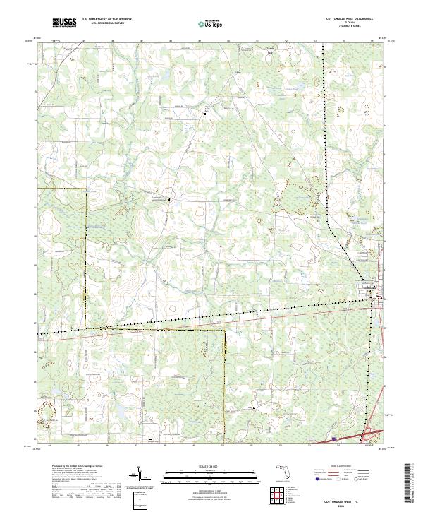
2024 Map of Cottondale West
USGS Topo · Published 2024About this map
Cottondale serves as a primary local center near the Washington Co and Jackson Co line, where the street grid of North ST, Front ST, and Main ST meets the regional rail infrastructure. This area of Florida is characterized by a high density of small water bodies and wetlands, including Bear Pond, Jackson Pond, and the expansive Drummond Bay. The landscape is dotted with numerous small cemeteries and church grounds such as the Pilgrim Rest Baptist Cem and Lovewood Freewill Baptist Church Cem, which are vital for genealogical research in this rural corridor. Significant watercourses like Gilberts Mill Creek and Little Alligator Creek drain the low-lying terrain, which is historically divided by a network of named country roads like Old Hickory Pond RD and Smokey RD. To the north, the small settlements of Glass and Jacob City provide further context for the early 21st-century settlement patterns of the panhandle.
Find a feature on this map
100 named features on this map. Tap any name to fly to it.
Don’t see what you’re looking for? This feature index may not catch every label — zoom into the map to look around manually.
Map Details
Editions of this 2024 Cottondale West Map
This is the sole edition of this map. No revisions or reprints were ever made.
Other maps of this area

1950 · Chipley
USGS Topo · 1:24,000

1950 · Wausau
USGS Topo · 1:24,000

1951 · Graceville
USGS Topo · 1:24,000

1951 · Chipley
USGS Topo · 1:24,000

1951 · Wausau
USGS Topo · 1:24,000

1952 · Kynesville
USGS Topo · 1:24,000

1952 · Cottondale East
USGS Topo · 1:24,000

1952 · Campbellton
USGS Topo · 1:24,000

1952 · Cottondale West
USGS Topo · 1:24,000

1952 · Sills
USGS Topo · 1:24,000