
1956 Map of Cottonwood Creek NE
USGS Topo · Published 1957About this map
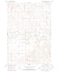
The Grand River meanders sharply across this central South Dakota landscape, defining the character of the terrain in the mid-1950s. This survey was conducted as part of the Department of the Interior's Missouri River Basin development program, documenting a sparse and largely undeveloped prairie region. The river's winding path is punctuated by a marked Ford, indicating the historical importance of river-crossing points in an area with limited infrastructure. To the north, the drainage of Lodge Creek carves through the uplands, while Cottonwood Creek feeds into the main river valley from the south. The absence of settlements or established roads highlights the territory's identity as open range and river bottomland during this era of federal land management and water resource planning.
Find a feature on this map
5 named features on this map. Tap any name to fly to it.
Don’t see what you’re looking for? This feature index may not catch every label — zoom into the map to look around manually.
Map Details
Editions of this 1956 Cottonwood Creek NE Map
2 editions found
Other maps of this area

1953 · McIntosh
USGS Topo · 1:250,000

1956 · Black Horse SW
USGS Topo · 1:24,000

1956 · Black Horse
USGS Topo · 1:24,000

1956 · Cottonwood Creek SE
USGS Topo · 1:24,000

1956 · Cottonwood Creek NW
USGS Topo · 1:24,000

1956 · Cottonwood Creek SW
USGS Topo · 1:24,000

1958 · McIntosh
USGS Topo · 1:250,000

1972 · McIntosh SW
USGS Topo · 1:24,000

1972 · Morristown SE
USGS Topo · 1:24,000

1972 · Skull Butte
USGS Topo · 1:24,000