
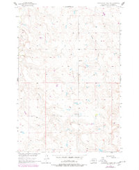
1956 Map of Cottonwood Creek SW
USGS Topo · Published 1957About this map
Black Horse Creek and Meadow Creek wind through this corner of Corson County, shaping a landscape defined by isolated rural outposts in the mid-1950s. The area demonstrates the sparse but organized settlement patterns of the South Dakota plains, where small schoolhouses served as the primary social and civic hubs. Traces of early 20th-century life are visible in the locations of Gopher Sch and Progress Sch, while a small mining footprint is preserved at the Stop Mine. The inclusion of the Homestead label and the Berry Dam reservoir suggests the persistent efforts of local families to manage water resources and maintain cattle or farming operations in this open terrain. Produced as part of a Department of the Interior program for the development of the Missouri River Basin, the map records the specific topographic character of the region following aerial photography in 1950.
Find a feature on this map
8 named features on this map. Tap any name to fly to it.
Don’t see what you’re looking for? This feature index may not catch every label — zoom into the map to look around manually.
Map Details
Editions of this 1956 Cottonwood Creek SW Map
2 editions found
Other maps of this area

1953 · McIntosh
USGS Topo · 1:250,000

1956 · Cottonwood Creek NE
USGS Topo · 1:24,000

1956 · Cottonwood Creek SE
USGS Topo · 1:24,000

1956 · Cottonwood Creek NW
USGS Topo · 1:24,000

1958 · McIntosh
USGS Topo · 1:250,000

1972 · Twin Butte
USGS Topo · 1:24,000

1972 · Black Horse Butte NE
USGS Topo · 1:24,000

1980 · McIntosh
USGS Topo · 1:100,000

1982 · Glad Valley
USGS Topo · 1:24,000
1982 · Irish Creek NW
USGS Topo · 1:24,000