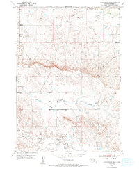
1953 Map of Cottonwood Draw
USGS Topo · Published 1994About this map
Antelope Creek and Cottonwood Draw define the drainage patterns of this Meade County landscape, where the high plains meet deep-cut draws and ridges. Based on fieldwork completed in the early 1950s, the map documents a sparse, rural environment focused on the natural watercourses that sustain life in this semi-arid region. Evidence of early local education is found at the Hall Sch (Abandoned), which stands as a quiet marker of changing population density and shifting rural school districts in the mid-20th century. To the south, Elk Creek and Morris Creek flow through the breaks, illustrating the rugged hydrological network that dictates the placement of trails and ranch boundaries across the South Dakota prairie.
Find a feature on this map
6 named features on this map. Tap any name to fly to it.
Don’t see what you’re looking for? This feature index may not catch every label — zoom into the map to look around manually.
Map Details
Editions of this 1953 Cottonwood Draw Map
3 editions found
Other maps of this area

1893 · Rapid
USGS Topo · 1:125,000

1898 · Rapid
USGS Topo · 1:125,000

1903 · Rapid
USGS Topo · 1:125,000

1953 · Bend
USGS Topo · 1:24,000

1953 · Rapid City 1 SW
USGS Topo · 1:24,000

1953 · Rapid City 1 NW
USGS Topo · 1:24,000

1953 · Blackhawk
USGS Topo · 1:24,000

1953 · Rapid City NW
USGS Topo · 1:24,000

1953 · Rapid City 1 NE
USGS Topo · 1:24,000

1953 · Rapid City 1 SE
USGS Topo · 1:24,000