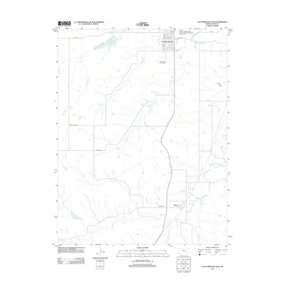
2012 Map of Cottonwood Falls
USGS Topo · Published 2012About this map
Cottonwood Falls serves as the focal point of this Chase County landscape, situated at a bend in the Cottonwood River. The town's grid is clearly defined by historic thoroughfares like Main St and W Union St, supporting local infrastructure including a Po and the Cottonwood Falls Airport. To the south, the settlement of Bazaar anchors a more rural expanse characterized by the convergence of several waterways. The area is defined by its drainage network, where the S Fork Cottonwood River meets numerous tributaries such as Rock Cr, Buck Cr, and Den Cr. This 2012 survey illustrates the relationship between the prairie terrain and the water resources that shaped local settlement, from the recreation area at Chase County State Lake to the quiet grounds of the Bazaar Cem.
Find a feature on this map
26 named features on this map. Tap any name to fly to it.
Don’t see what you’re looking for? This feature index may not catch every label — zoom into the map to look around manually.
Map Details
Editions of this 2012 Cottonwood Falls Map
This is the sole edition of this map. No revisions or reprints were ever made.
Other maps of this area

1888 · Emporia
USGS Topo · 1:125,000

1894 · Emporia
USGS Topo · 1:125,000

1898 · Cottonwood Falls
USGS Topo · 1:125,000

1955 · Hutchinson
USGS Topo · 1:250,000

1957 · Elmdale
USGS Topo · 1:24,000

1957 · Strong City
USGS Topo · 1:24,000

1957 · Saffordville
USGS Topo · 1:24,000

1957 · Hymer
USGS Topo · 1:24,000

1959 · Hutchinson
USGS Topo · 1:250,000

1973 · Matfield Green
USGS Topo · 1:24,000