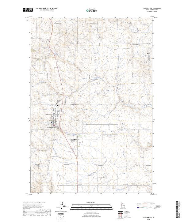
2024 Map of Cottonwood
USGS Topo · Published 2024About this map
Cottonwood serves as the primary hub on this Camas Prairie landscape, where a dense grid of streets including Main St and Lewiston St anchors the local community. The town is flanked by essential local landmarks, notably the Cottonwood Municipal Airport to the south and the Saint Marys Catholic Cem to the north. This high-plateau region is defined by its agricultural layout, with roads like Reservation Line Rd and Jentges Rd tracing the section lines between rolling drainages.
Find a feature on this map
60 named features on this map. Tap any name to fly to it.
Don’t see what you’re looking for? This feature index may not catch every label — zoom into the map to look around manually.
Map Details
Editions of this 2024 Cottonwood Map
This is the sole edition of this map. No revisions or reprints were ever made.
Other maps of this area

1924 · Kamiah
USGS Topo · 1:125,000

1955 · Pullman
USGS Topo · 1:250,000

1955 · Grangeville
USGS Topo · 1:250,000

1958 · Pullman
USGS Topo · 1:250,000

1959 · Grangeville
USGS Topo · 1:250,000

1963 · Grangeville West
USGS Topo · 1:24,000

1963 · Moughmer Point
USGS Topo · 1:24,000
1963 · Fenn
USGS Topo · 1:24,000

1967 · Craigmont
USGS Topo · 1:24,000
1967 · Nezperce SW
USGS Topo · 1:24,000