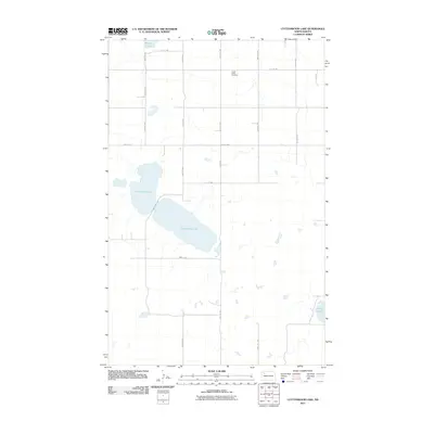
2011 Map of Cottonwood Lake
USGS Topo · Published 2011About this map
Cottonwood Lake dominates this central Mountrail County landscape, which remains defined by its glacial hydrology and a strict grid of section-line roads. At the beginning of the twenty-first century, the area preserved its rural character through established landmarks such as the Lunds Valley Cemetery in the northeast and water bodies like Powers Lake and White Lake. The map illustrates a high density of seasonal wetlands and small prairie potholes scattered throughout the township, highlighting the intricate drainage patterns of the Missouri Coteau region. Local transport relies on a series of numbered avenues and streets, including 89th Ave NW and 74th St NW, which facilitate access to the surrounding farmsteads and agricultural plots that define the region's economy.
Find a feature on this map
15 named features on this map. Tap any name to fly to it.
Don’t see what you’re looking for? This feature index may not catch every label — zoom into the map to look around manually.
Map Details
Editions of this 2011 Cottonwood Lake Map
This is the sole edition of this map. No revisions or reprints were ever made.
Other maps of this area

1953 · Williston
USGS Topo · 1:250,000

1957 · Williston
USGS Topo · 1:250,000

1969 · Ross NW
USGS Topo · 1:24,000

1969 · Stanley
USGS Topo · 1:24,000

1974 · Lostwood Lakes
USGS Topo · 1:24,000

1977 · Powers Lake
USGS Topo · 1:24,000
1978 · Lunds Valley
USGS Topo · 1:24,000

1981 · Ross
USGS Topo · 1:24,000

1981 · Manitou
USGS Topo · 1:24,000

1981 · Lostwood
USGS Topo · 1:24,000