
1969 Map of Stanley
USGS Topo · Published 1971About this map
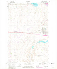
Stanley serves as the primary hub of activity in this northern plains landscape, situated at the intersection of the Burlington Northern railroad and regional roadways. The town center is well-defined, featuring a High Sch, the Fairview Cem, and a dedicated Rest Home. To the south, the landscape is shaped by the Little Knife River, where the Stanley Dam creates a significant reservoir near several gravel operations. The northern portion of the map is dominated by the sprawling White Lake and the National Wildlife Management Area, highlighting the region's focus on conservation and natural water resources. Local infrastructure is further supported by the Stanley Airfield, reflecting the importance of aerial connectivity in this expansive terrain.
Find a feature on this map
22 named features on this map. Tap any name to fly to it.
Don’t see what you’re looking for? This feature index may not catch every label — zoom into the map to look around manually.
Map Details
Editions of this 1969 Stanley Map
2 editions found
Other maps of this area

1953 · Williston
USGS Topo · 1:250,000

1957 · Williston
USGS Topo · 1:250,000

1969 · Stanley SE
USGS Topo · 1:24,000

1981 · Robinson Lake
USGS Topo · 1:24,000

1981 · Ross
USGS Topo · 1:24,000

1981 · Stanley SE
USGS Topo · 1:24,000

1981 · Lostwood
USGS Topo · 1:24,000
1981 · Cottonwood Lake
USGS Topo · 1:24,000
1981 · Sikes Dam
USGS Topo · 1:24,000
1981 · Clearwater Lake
USGS Topo · 1:24,000