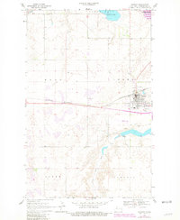
1969 Map of Stanley
USGS Topo · Published 1981About this map
Stanley serves as the central hub of activity in this North Dakota landscape, situated at the intersection of the Burlington Northern railroad and regional roadways. The town’s social and municipal infrastructure is well-defined, including the High Sch, Fairview Cem, and a Rest Home, alongside recreational spaces like the local Golf Course and Campground. The surrounding geography is defined by a mix of glacial prairie potholes and more significant water features, such as the expansive White Lake to the north and the Stanley Dam reservoir south of town.
Find a feature on this map
19 named features on this map. Tap any name to fly to it.
Don’t see what you’re looking for? This feature index may not catch every label — zoom into the map to look around manually.
Map Details
Editions of this 1969 Stanley Map
2 editions found
Other maps of this area

1953 · Williston
USGS Topo · 1:250,000

1957 · Williston
USGS Topo · 1:250,000

1969 · Stanley
USGS Topo · 1:24,000

1969 · Stanley SE
USGS Topo · 1:24,000

1981 · Robinson Lake
USGS Topo · 1:24,000

1981 · Ross
USGS Topo · 1:24,000

1981 · Stanley SE
USGS Topo · 1:24,000

1981 · Lostwood
USGS Topo · 1:24,000
1981 · Cottonwood Lake
USGS Topo · 1:24,000
1981 · Sikes Dam
USGS Topo · 1:24,000