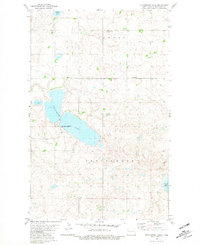
1981 Map of Cottonwood Lake
USGS Topo · Published 1981About this map
Cottonwood Lake dominates this prairie landscape, serving as the centerpiece for the National Waterfowl Production Area which occupies much of its shoreline. This 1981 edition, based on earlier surveys and photogrammetric methods from the 1970s, captures a transition in the rural environment of northwestern North Dakota. The area is divided between the civil townships of Powers and Cottonwood, where the small settlement of Townhall stands as a local administrative marker. The land is dotted with countless small sloughs and wetlands characteristic of the drift prairie, including Powers Lake at the northern edge and White Lake to the southeast. Genealogists and local historians will find the Lunds Valley Cem and the landmark Vale provide specific anchor points for family research in this sparsely populated agricultural region.
Find a feature on this map
11 named features on this map. Tap any name to fly to it.
Don’t see what you’re looking for? This feature index may not catch every label — zoom into the map to look around manually.
Map Details
Editions of this 1981 Cottonwood Lake Map
This is the sole edition of this map. No revisions or reprints were ever made.
Other maps of this area

1953 · Williston
USGS Topo · 1:250,000

1957 · Williston
USGS Topo · 1:250,000

1969 · Ross NW
USGS Topo · 1:24,000

1969 · Stanley
USGS Topo · 1:24,000

1974 · Lostwood Lakes
USGS Topo · 1:24,000

1977 · Powers Lake
USGS Topo · 1:24,000
1978 · Lunds Valley
USGS Topo · 1:24,000

1981 · Ross
USGS Topo · 1:24,000

1981 · Manitou
USGS Topo · 1:24,000

1981 · Lostwood
USGS Topo · 1:24,000