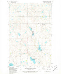
1981 Map of Clearwater Lake
USGS Topo · Published 1981About this map
The Missouri Plateau landscape of Mountrail County is defined here by a dense concentration of prairie potholes and wetlands, most notably Clearwater Lake and the elongated Miller Slough. Large tracts of the area are dedicated to conservation through the National Waterfowl Production Area, reflecting the region's importance within the Central Flyway. These protected lands are interspersed with private holdings and sections of the Burlington Northern railroad, which cuts through the southwestern corner of the quadrangle.
Find a feature on this map
11 named features on this map. Tap any name to fly to it.
Don’t see what you’re looking for? This feature index may not catch every label — zoom into the map to look around manually.
Map Details
Editions of this 1981 Clearwater Lake Map
This is the sole edition of this map. No revisions or reprints were ever made.
Other maps of this area

1949 · Mosquito Butte
USGS Topo · 1:24,000

1950 · Kenmare
USGS Topo · 1:62,500

1953 · Williston
USGS Topo · 1:250,000

1957 · Williston
USGS Topo · 1:250,000

1969 · Stanley
USGS Topo · 1:24,000

1969 · Stanley SE
USGS Topo · 1:24,000

1974 · Lostwood Lakes
USGS Topo · 1:24,000

1978 · Westby Lake
USGS Topo · 1:24,000

1981 · Stanley SE
USGS Topo · 1:24,000

1981 · Lostwood
USGS Topo · 1:24,000