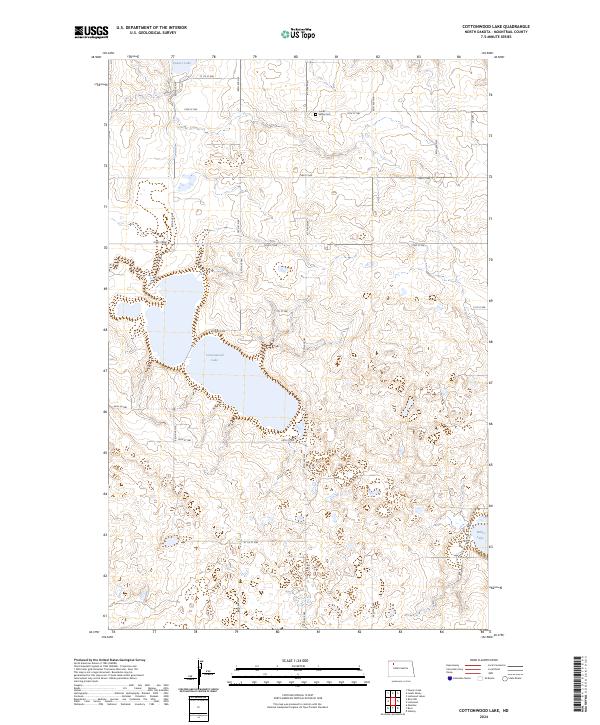
2024 Map of Cottonwood Lake
USGS Topo · Published 2024About this map
The glaciated plains of North Dakota's prairie pothole region are defined by significant water bodies such as Cottonwood Lake and the southern reaches of Powers Lake. This landscape in Mountrail County is characterized by numerous small depressions and sloughs, many of which are protected within the Mountrail County Waterfowl Production Area. The area remains sparsely populated and largely agricultural, organized by a rigid grid of rural roads including 88th Ave NW and 74th St NW. For genealogists and local historians, the Lunds Valley Cem stands as a primary landmark for tracing early settlement history in Township 158 North, Range 92 West. Toward the southeast, White Lake marks the edge of this complex hydrologic network, illustrating the era's ongoing commitment to wildlife conservation and rural land management.
Find a feature on this map
21 named features on this map. Tap any name to fly to it.
Don’t see what you’re looking for? This feature index may not catch every label — zoom into the map to look around manually.
Map Details
Editions of this 2024 Cottonwood Lake Map
This is the sole edition of this map. No revisions or reprints were ever made.
Other maps of this area

1953 · Williston
USGS Topo · 1:250,000

1957 · Williston
USGS Topo · 1:250,000

1969 · Ross NW
USGS Topo · 1:24,000

1969 · Stanley
USGS Topo · 1:24,000

1974 · Lostwood Lakes
USGS Topo · 1:24,000

1977 · Powers Lake
USGS Topo · 1:24,000
1978 · Lunds Valley
USGS Topo · 1:24,000

1981 · Ross
USGS Topo · 1:24,000

1981 · Manitou
USGS Topo · 1:24,000

1981 · Lostwood
USGS Topo · 1:24,000