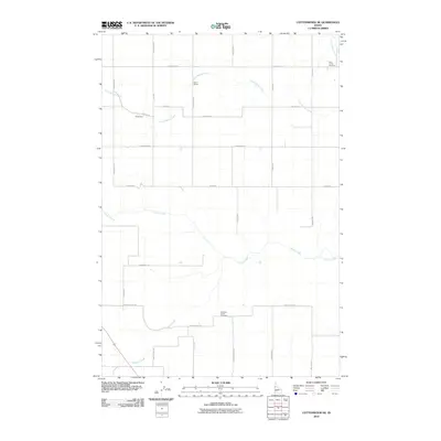
2010 Map of Cottonwood NE
USGS Topo · Published 2010About this map
Lawyer Creek and Long Hollow Creek carve deep drainage patterns across this Idaho County landscape, defining the rural character of the region. The map reveals a strictly organized grid of agricultural roads, such as Evergreen Rd and Jacobs Rd, which service a high plateau dissected by these watercourses. Small settlements like Christmans and the rail-related Harris Siding appear as quiet centers of activity within this expanse of farmland. Genealogists will find particular value in the presence of Holy Trinity Cemetery in the northeast and Meadow Creek Cemetery in the south, both serving as anchors for the local families who established these remote reaches. The inclusion of named transit routes like 7 Mile Cutoff Rd and Funk Cutoff Rd highlights the practical navigation required in a landscape defined by its topography and the meandering path of Meadow Creek.
Find a feature on this map
26 named features on this map. Tap any name to fly to it.
Don’t see what you’re looking for? This feature index may not catch every label — zoom into the map to look around manually.
Map Details
Editions of this 2010 Cottonwood NE Map
This is the sole edition of this map. No revisions or reprints were ever made.
Other maps of this area

1924 · Kamiah
USGS Topo · 1:125,000

1955 · Pullman
USGS Topo · 1:250,000

1958 · Pullman
USGS Topo · 1:250,000

1967 · Mohler
USGS Topo · 1:24,000

1967 · Fletcher
USGS Topo · 1:24,000

1967 · Craigmont
USGS Topo · 1:24,000
1967 · Nezperce SW
USGS Topo · 1:24,000

1967 · Sixmile Creek
USGS Topo · 1:24,000
1967 · Keuterville
USGS Topo · 1:24,000

1967 · Cottonwood NE
USGS Topo · 1:24,000