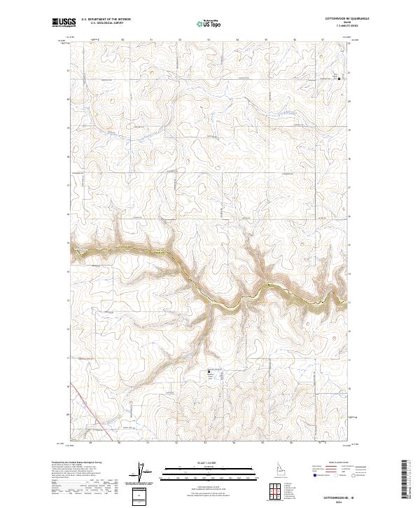
2024 Map of Cottonwood NE
USGS Topo · Published 2024About this map
Lawyer Creek carves a deep, winding path through the central landscape of this Idaho region, marking the boundary between Lewis Co and Idaho Co. This modern topographic survey reveals a rugged plateau dominated by rural roads and scattered watercourses such as Long Hollow Creek and Meadow Creek. The network of local routes, including Shortcut Rd, Cemetery Rd, and Windy Ridge Rd, follows the contours of the high ground above the creek breaks. For those researching local history or genealogy, the map identifies specific sites such as Holy Trinity Cem in the northeast and Meadow Creek Cem near Riener Rd. The grid of the Public Land Survey System is clearly visible, with section lines and township markers like t33n r1e providing a structured view of land ownership and agricultural divisions in the vicinity of Cottonwood.
Find a feature on this map
35 named features on this map. Tap any name to fly to it.
Don’t see what you’re looking for? This feature index may not catch every label — zoom into the map to look around manually.
Map Details
Editions of this 2024 Cottonwood NE Map
This is the sole edition of this map. No revisions or reprints were ever made.
Other maps of this area

1924 · Kamiah
USGS Topo · 1:125,000

1955 · Pullman
USGS Topo · 1:250,000

1958 · Pullman
USGS Topo · 1:250,000

1967 · Mohler
USGS Topo · 1:24,000

1967 · Fletcher
USGS Topo · 1:24,000

1967 · Craigmont
USGS Topo · 1:24,000
1967 · Nezperce SW
USGS Topo · 1:24,000

1967 · Sixmile Creek
USGS Topo · 1:24,000
1967 · Keuterville
USGS Topo · 1:24,000

1967 · Cottonwood NE
USGS Topo · 1:24,000