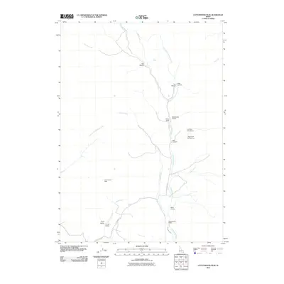
2010 Map of Cottonwood Peak
USGS Topo · Published 2010About this map
Cottonwood Valley lies at the heart of this Idaho landscape, where the drainage of Cottonwood Creek has carved a complex network of canyons and gulches. The terrain is defined by its deep vertical relief, moving from the heights of Cottonwood Peak down through family-named landmarks like Walker Gulch and Jacobson Creek. The presence of the Treasureton Canal in the southern reaches of the quadrangle indicates the vital importance of water management in this high-altitude environment, supporting the small settlements at Hog Wallow and the surrounding valley floor.
Find a feature on this map
29 named features on this map. Tap any name to fly to it.
Don’t see what you’re looking for? This feature index may not catch every label — zoom into the map to look around manually.
Map Details
Editions of this 2010 Cottonwood Peak Map
This is the sole edition of this map. No revisions or reprints were ever made.
Other maps of this area

1915 · Preston
USGS Topo · 1:96,000

1918 · Preston
USGS Topo · 1:125,000

1948 · Bancroft
USGS Topo · 1:62,500

1949 · Bancroft
USGS Topo · 1:62,500

1954 · Pocatello
USGS Topo · 1:250,000

1955 · Preston
USGS Topo · 1:250,000

1958 · Pocatello
USGS Topo · 1:250,000

1958 · Preston
USGS Topo · 1:250,000

1962 · Preston
USGS Topo · 1:250,000

1968 · Oxford
USGS Topo · 1:24,000