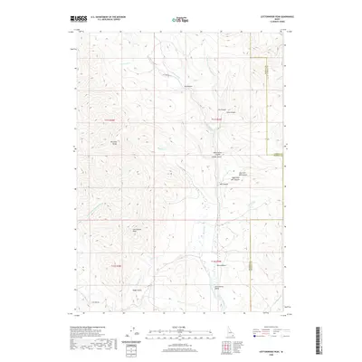
2020 Map of Cottonwood Peak
USGS Topo · Published 2020About this map
Cottonwood Peak dominates this high-altitude landscape within the Portneuf Range, marking a dramatic intersection of the Bannock Co and Caribou Co borders. The terrain is characterized by a complex network of drainages and named depressions, such as Hog Wallow, Walker Gulch, and Mine Hollow. To the south, the land transitions into the Cottonwood Valley, where the Treasureton Canal reflects the agricultural development and water management essential to this corner of Idaho.
Find a feature on this map
36 named features on this map. Tap any name to fly to it.
Don’t see what you’re looking for? This feature index may not catch every label — zoom into the map to look around manually.
Map Details
Editions of this 2020 Cottonwood Peak Map
This is the sole edition of this map. No revisions or reprints were ever made.
Other maps of this area

1915 · Preston
USGS Topo · 1:96,000

1918 · Preston
USGS Topo · 1:125,000

1948 · Bancroft
USGS Topo · 1:62,500

1949 · Bancroft
USGS Topo · 1:62,500

1954 · Pocatello
USGS Topo · 1:250,000

1955 · Preston
USGS Topo · 1:250,000

1958 · Pocatello
USGS Topo · 1:250,000

1958 · Preston
USGS Topo · 1:250,000

1962 · Preston
USGS Topo · 1:250,000

1968 · Oxford
USGS Topo · 1:24,000