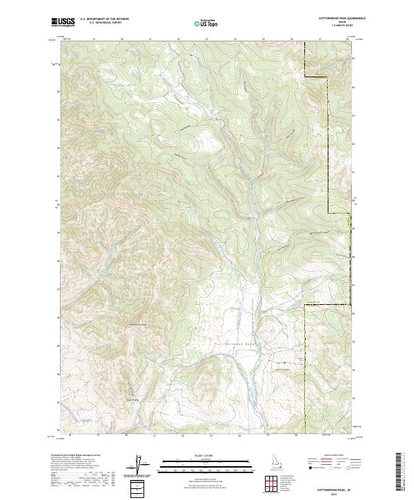
2023 Map of Cottonwood Peak
USGS Topo · Published 2023About this map
The high ridges of the Portneuf Range dominate this landscape, rising to the prominent summit of Cottonwood Peak. This high-altitude terrain in southeast Idaho is defined by a complex network of canyons and gulches, including the colorfully named Hog Wallow and Bullwhacker Canyon. Settlement is sparse, with development largely confined to the lower elevations of Cottonwood Valley, where the Preston Canal and roads like Cottonwood Rd trace the path of the water and early transportation routes.
Find a feature on this map
38 named features on this map. Tap any name to fly to it.
Don’t see what you’re looking for? This feature index may not catch every label — zoom into the map to look around manually.
Map Details
Editions of this 2023 Cottonwood Peak Map
This is the sole edition of this map. No revisions or reprints were ever made.
Other maps of this area

1915 · Preston
USGS Topo · 1:96,000

1918 · Preston
USGS Topo · 1:125,000

1948 · Bancroft
USGS Topo · 1:62,500

1949 · Bancroft
USGS Topo · 1:62,500

1954 · Pocatello
USGS Topo · 1:250,000

1955 · Preston
USGS Topo · 1:250,000

1958 · Pocatello
USGS Topo · 1:250,000

1958 · Preston
USGS Topo · 1:250,000

1962 · Preston
USGS Topo · 1:250,000

1968 · Oxford
USGS Topo · 1:24,000