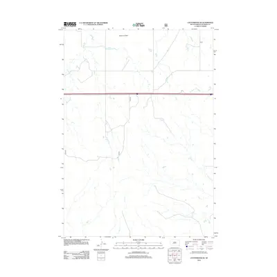
2012 Map of Cottonwood SE
USGS Topo · Published 2012About this map
Washburn Ridge defines the northern topography of this Jackson County landscape, overlooking a series of drainage networks that flow across the high plains. The area is characterized by the branching paths of Big Buffalo Creek and Little Buffalo Creek, which carve distinct patterns into the terrain. In this modern era of ranching and transit, the southern reaches are marked by the winding courses of Fifteen Creek and Cut Creek, illustrating the natural watershed before these seasonal streams converge. A primary corridor of travel is represented by Interstate 90, which cuts a straight line across the prairie, serving as the main artery for regional commerce and travel through this part of South Dakota.
Find a feature on this map
6 named features on this map. Tap any name to fly to it.
Don’t see what you’re looking for? This feature index may not catch every label — zoom into the map to look around manually.
Map Details
Editions of this 2012 Cottonwood SE Map
This is the sole edition of this map. No revisions or reprints were ever made.
Other maps of this area

1950 · Interior
USGS Topo · 1:24,000

1950 · Weta
USGS Topo · 1:24,000

1951 · Wanblee NW
USGS Topo · 1:24,000

1951 · School Section Butte
USGS Topo · 1:24,000

1953 · Philip Junction
USGS Topo · 1:24,000

1955 · Martin
USGS Topo · 1:250,000

1958 · Martin
USGS Topo · 1:250,000

1960 · Cottonwood SW
USGS Topo · 1:24,000

1961 · Cottonwood
USGS Topo · 1:24,000

1961 · Cottonwood NE
USGS Topo · 1:24,000