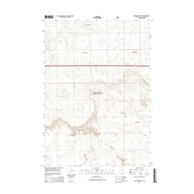
2015 Map of Cottonwood SE
USGS Topo · Published 2015About this map
Buffalo Gap National Grassland dominates this section of the western South Dakota plains, where the open landscape is defined by the drainage systems of the White River basin. The terrain rises significantly toward Washburn Ridge in the northwest, while several watercourses including Big Buffalo Cr and Little Buffalo Cr carve paths through the township. Public land management is central to this area, as reflected in the grid-based boundaries of t2s r19e and t3s r20e. Local transportation is sparse, consisting primarily of the north-south Cs 21 route and Interstate 90 crossing the northern third of the quadrangle. For those studying the environmental history of the Great Plains, the map illustrates the persistence of native grassland management in a region characterized by ephemeral streams like Fifteen Cr and Cut Cr.
Find a feature on this map
11 named features on this map. Tap any name to fly to it.
Don’t see what you’re looking for? This feature index may not catch every label — zoom into the map to look around manually.
Map Details
Editions of this 2015 Cottonwood SE Map
This is the sole edition of this map. No revisions or reprints were ever made.
Other maps of this area

1950 · Interior
USGS Topo · 1:24,000

1950 · Weta
USGS Topo · 1:24,000

1951 · Wanblee NW
USGS Topo · 1:24,000

1951 · School Section Butte
USGS Topo · 1:24,000

1953 · Philip Junction
USGS Topo · 1:24,000

1955 · Martin
USGS Topo · 1:250,000

1958 · Martin
USGS Topo · 1:250,000

1960 · Cottonwood SW
USGS Topo · 1:24,000

1961 · Cottonwood
USGS Topo · 1:24,000

1961 · Cottonwood NE
USGS Topo · 1:24,000