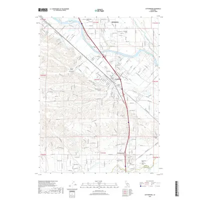
2018 Map of Cottonwood
USGS Topo · Published 2018About this map
The Sacramento River carves a winding path through this northern California landscape, acting as a geographic divider between the Stillwater Plains to the east and the rising foothills to the west. The 2018 survey documents the urban footprints of Anderson and the northern edge of Cottonwood, where the historical importance of water management is visible through the Anderson Cottonwood Canal. This infrastructure, coupled with the numerous gulches like Telephone Gulch and Spanish Canyon, reveals how the terrain has been navigated and utilized for both agriculture and settlement.
Find a feature on this map
210 named features on this map. Tap any name to fly to it.
Don’t see what you’re looking for? This feature index may not catch every label — zoom into the map to look around manually.
Map Details
Editions of this 2018 Cottonwood Map
This is the sole edition of this map. No revisions or reprints were ever made.
Other maps of this area

1890 · Red Bluff
USGS Topo · 1:250,000

1894 · Red Bluff
USGS Topo · 1:250,000

1901 · Redding
USGS Topo · 1:125,000

1932 · Olinda
USGS Topo · 1:31,680

1935 · Olinda
USGS Topo · 1:31,680

1944 · Redding
USGS Topo · 1:62,500

1944 · Tuscan Buttes
USGS Topo · 1:62,500

1946 · Redding
USGS Topo · 1:62,500

1947 · Tuscan Buttes
USGS Topo · 1:62,500

1947 · Anderson
USGS Topo · 1:62,500