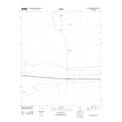
2012 Map of Cottonwood Spring
USGS Topo · Published 2012About this map
Cottonwood Spring and its surrounding desert landscape are defined by vital water sources and the infrastructure of the American Southwest. The 2012 survey illustrates a topography of high peaks and low washes, including the prominent Mastedon Peak and the geological formation of Buried Mountain within Shavers Valley. Human intervention in this arid environment is most notable through the presence of the Colorado River Aqueduct, which bisects the terrain. Local travel and recreation are concentrated around the Cottonwood Campground and the access provided by Cottonwood Spring Rd, Pinto Rd, and Box Canyon Rd. To the east, smaller natural refuges like the Lost Palms Oasis and Victory Palms suggest the specialized ecology of the region, while the Cottonwood Pass and Cottonwood Canyon provide natural corridors through the varied elevation of the Riverside County desert.
Find a feature on this map
15 named features on this map. Tap any name to fly to it.
Don’t see what you’re looking for? This feature index may not catch every label — zoom into the map to look around manually.
Map Details
Editions of this 2012 Cottonwood Spring Map
This is the sole edition of this map. No revisions or reprints were ever made.
Other maps of this area

1940 · Cottonwood Spring
USGS Topo · 1:62,500

1940 · Canyon Spring
USGS Topo · 1:62,500

1943 · Canyon Spring
USGS Topo · 1:62,500

1943 · Pinkham Well
USGS Topo · 1:62,500

1944 · Cottonwood Spring
USGS Topo · 1:62,500

1944 · Pinkham Well
USGS Topo · 1:62,500

1944 · Eagle Tank
USGS Topo · 1:62,500

1954 · Salton Sea
USGS Topo · 1:250,000

1955 · Salton Sea
USGS Topo · 1:250,000
1958 · Orocopia Canyon
USGS Topo · 1:24,000