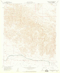
1958 Map of Orocopia Canyon
USGS Topo · Published 1959About this map
Orocopia Mountains dominate this arid landscape, characterized by the dramatic relief of the Orocopia Canyon and the desert floor's transition toward the Chocolate Mountain range. Human intervention in this environment is clearly marked by the infrastructure of the Coachella Canal, which cuts across the southern portion of the sheet. The engineering of this waterway is underscored by numerous technical features including a Levee, Dike, and several Siphons.
Find a feature on this map
14 named features on this map. Tap any name to fly to it.
Don’t see what you’re looking for? This feature index may not catch every label — zoom into the map to look around manually.
Map Details
Editions of this 1958 Orocopia Canyon Map
4 editions found
Other maps of this area

1940 · Frink
USGS Topo · 1:62,500

1940 · Cottonwood Spring
USGS Topo · 1:62,500

1940 · Canyon Spring
USGS Topo · 1:62,500

1940 · Durmid
USGS Topo · 1:62,500

1943 · Canyon Spring
USGS Topo · 1:62,500

1944 · Cottonwood Spring
USGS Topo · 1:62,500

1944 · Durmid
USGS Topo · 1:62,500

1944 · Frink
USGS Topo · 1:62,500

1954 · Salton Sea
USGS Topo · 1:250,000

1955 · Salton Sea
USGS Topo · 1:250,000