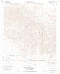
1958 Map of Orocopia Canyon
USGS Topo · Published 1976About this map
Orocopia Mountains dominate this 1958 survey, showing the arid Riverside County landscape at the edge of the Salton Sink. The topography is defined by the stark Orocopia ridges and the deep Canyon floor, where the environment is dictated by scarce water sources. At the southern base of the range, the Coachella Canal introduces a linear human-made boundary, complete with a supporting Levee and Dike system designed to manage water flow across the desert floor.
Find a feature on this map
15 named features on this map. Tap any name to fly to it.
Don’t see what you’re looking for? This feature index may not catch every label — zoom into the map to look around manually.
Map Details
Editions of this 1958 Orocopia Canyon Map
4 editions found
Other maps of this area

1940 · Frink
USGS Topo · 1:62,500

1940 · Cottonwood Spring
USGS Topo · 1:62,500

1940 · Canyon Spring
USGS Topo · 1:62,500

1940 · Durmid
USGS Topo · 1:62,500

1943 · Canyon Spring
USGS Topo · 1:62,500

1944 · Cottonwood Spring
USGS Topo · 1:62,500

1944 · Durmid
USGS Topo · 1:62,500

1944 · Frink
USGS Topo · 1:62,500

1954 · Salton Sea
USGS Topo · 1:250,000

1955 · Salton Sea
USGS Topo · 1:250,000