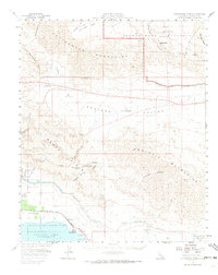
1958 Map of Cottonwood Spring
USGS Topo · Published 1973About this map
The Cottonwood Mountains and Orocopia Mountains dominate this mid-century survey of the California desert, capturing a landscape defined by critical water infrastructure and recreation. The Colorado River Aqueduct traverses the northern terrain through the Mecca Pass Tunnels, while the southern end of the map reveals the shoreline of the Salton Sea and the path of the Coachella Canal.
Find a feature on this map
43 named features on this map. Tap any name to fly to it.
Don’t see what you’re looking for? This feature index may not catch every label — zoom into the map to look around manually.
Map Details
Editions of this 1958 Cottonwood Spring Map
3 editions found
Other maps of this area

1904 · Indio
USGS Topo · 1:125,000

1931 · Vallecito
USGS Topo · 1:125,000

1940 · Frink
USGS Topo · 1:62,500

1940 · Cottonwood Spring
USGS Topo · 1:62,500

1940 · Canyon Spring
USGS Topo · 1:62,500

1940 · Durmid
USGS Topo · 1:62,500

1941 · Coachella
USGS Topo · 1:62,500

1942 · Agua Dulce
USGS Topo · 1:62,500

1943 · Vallecito
USGS Topo · 1:125,000

1943 · Canyon Spring
USGS Topo · 1:62,500