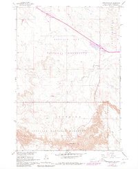
1960 Map of Cottonwood SW
USGS Topo · Published 1980About this map
Buffalo Gap National Grassland dominates the northern half of this Jackson County landscape, while the southern portion transitions into the eroded formations of Badlands National Monument. The settlement of Cactus Flats serves as a small waypoint along the highway, positioned near a local pit and a Gravel Pit. The terrain is marked by dramatic elevation changes, including Big Foot Hill and Millard Ridge, which overlook the winding path of Big Buffalo Creek. Several points identified as Scenic Overlook provide views across the rugged badlands topography. The map also delineates the northern boundary of Interior, showing a network of secondary roads and a Jeep Trail that penetrate the remote grasslands and monument lands, illustrating the region's sparse development and focus on land conservation during the mid-20th century.
Find a feature on this map
12 named features on this map. Tap any name to fly to it.
Don’t see what you’re looking for? This feature index may not catch every label — zoom into the map to look around manually.
Map Details
Editions of this 1960 Cottonwood SW Map
2 editions found
Other maps of this area

1950 · Interior
USGS Topo · 1:24,000

1951 · School Section Butte
USGS Topo · 1:24,000

1952 · Conata NE
USGS Topo · 1:24,000

1955 · Hot Springs
USGS Topo · 1:250,000

1955 · Martin
USGS Topo · 1:250,000

1958 · Martin
USGS Topo · 1:250,000

1960 · Wall SE
USGS Topo · 1:24,000

1960 · Cottonwood SW
USGS Topo · 1:24,000

1961 · Cottonwood
USGS Topo · 1:24,000

1961 · Cottonwood NE
USGS Topo · 1:24,000