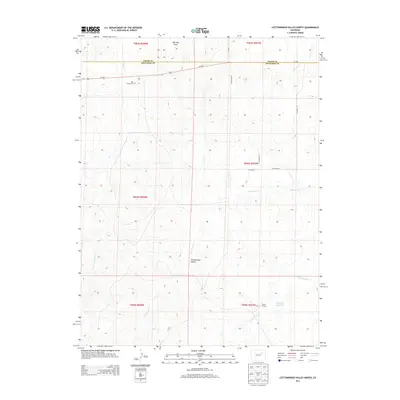
2013 Map of Cottonwood Valley North
USGS Topo · Published 2013About this map
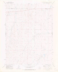
Cottonwood Valley defines this eastern Colorado landscape, where the high plains are carved by a network of seasonal drainage ways. The map captures the quiet intersection of Adams and Arapahoe Counties, a region dominated by ranching and agricultural operations like the Arrow K Ranch. A notable genealogical landmark is the Jolly Family Cem, situated just south of Us-36 E, which serves as the primary east-west artery across the northern section of the quadrangle. Water management is critical in this arid environment, evidenced by the Jolly John Reservoir and the multiple named creeks including Cottonwood Cr, Rattlesnake Cr, and Badger Cr. The grid of county roads, such as S Co Road 273 and Co Road 14, provides the framework for the sparsely populated townships that stretch toward Mail Box Draw.
Find a feature on this map
23 named features on this map. Tap any name to fly to it.
Don’t see what you’re looking for? This feature index may not catch every label — zoom into the map to look around manually.
Map Details
Editions of this 2013 Cottonwood Valley North Map
This is the sole edition of this map. No revisions or reprints were ever made.
Other maps of this area

1954 · Limon
USGS Topo · 1:250,000

1957 · Limon
USGS Topo · 1:250,000

1958 · Limon
USGS Topo · 1:250,000
1969 · Noonen Reservoir SW
USGS Topo · 1:24,000
1969 · Noonen Reservoir
USGS Topo · 1:24,000

1973 · Last Chance SW
USGS Topo · 1:24,000
1973 · Cottonwood Valley South
USGS Topo · 1:24,000

1973 · Last Chance NW
USGS Topo · 1:24,000
1973 · Cottonwood Valley North
USGS Topo · 1:24,000

1973 · Wetzel Creek
USGS Topo · 1:24,000