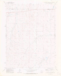
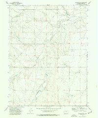
1973 Map of Cottonwood Valley North
USGS Topo · Published 1976About this map
The high plains of the Adams Co Arapahoe Co boundary line define this 1970s landscape, where drainage patterns and energy extraction intersect. The topographical centerpiece is the Cottonwood Valley, a broad depression carved by the seasonal flows of Cottonwood Creek and its tributaries. While much of the land appears as open range, the presence of an extensive Pipeline and several scattered Oil Wells in the northern sections signals the region's mid-century petroleum development. Human habitation is sparse on this sheet, anchored primarily by the Arrow K Ranch in the southeast. This survey captures the area just after the early 1970s energy shifts, documenting the precise location of ranching homesteads and infrastructure before later suburban expansion or further industrial changes altered the rural character of these Colorado plains.
Find a feature on this map
9 named features on this map. Tap any name to fly to it.
Don’t see what you’re looking for? This feature index may not catch every label — zoom into the map to look around manually.
Map Details
Editions of this 1973 Cottonwood Valley North Map
This is the sole edition of this map. No revisions or reprints were ever made.
Other maps of this area

1954 · Limon
USGS Topo · 1:250,000

1957 · Limon
USGS Topo · 1:250,000

1958 · Limon
USGS Topo · 1:250,000
1969 · Noonen Reservoir SW
USGS Topo · 1:24,000
1969 · Noonen Reservoir
USGS Topo · 1:24,000

1973 · Last Chance SW
USGS Topo · 1:24,000
1973 · Cottonwood Valley South
USGS Topo · 1:24,000

1973 · Last Chance NW
USGS Topo · 1:24,000

1973 · Wetzel Creek
USGS Topo · 1:24,000
1973 · Shamrock SE
USGS Topo · 1:24,000