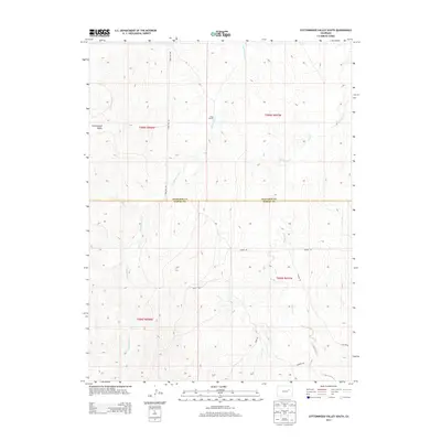
2013 Map of Cottonwood Valley South
USGS Topo · Published 2013About this map
Cottonwood Valley defines the western landscape of this Arapahoe County region, where the high plains terrain is carved by a network of seasonal watercourses. The map documents a predominantly rural ranching environment, anchored by the Cross J Ranch situated near the headwaters of Rattlesnake Cr. This drainage, along with Cottonwood Cr and Beaver Cr, creates a series of north-south corridors through the rolling topography.
Find a feature on this map
16 named features on this map. Tap any name to fly to it.
Don’t see what you’re looking for? This feature index may not catch every label — zoom into the map to look around manually.
Map Details
Editions of this 2013 Cottonwood Valley South Map
This is the sole edition of this map. No revisions or reprints were ever made.
Other maps of this area

1891 · Limon
USGS Topo · 1:125,000

1892 · Limon
USGS Topo · 1:125,000

1954 · Limon
USGS Topo · 1:250,000

1957 · Limon
USGS Topo · 1:250,000

1958 · Limon
USGS Topo · 1:250,000
1969 · Noonen Reservoir SW
USGS Topo · 1:24,000
1969 · Noonen Reservoir
USGS Topo · 1:24,000

1970 · Agate
USGS Topo · 1:24,000
1970 · Barking Dog Spring
USGS Topo · 1:24,000

1970 · T Draw
USGS Topo · 1:24,000