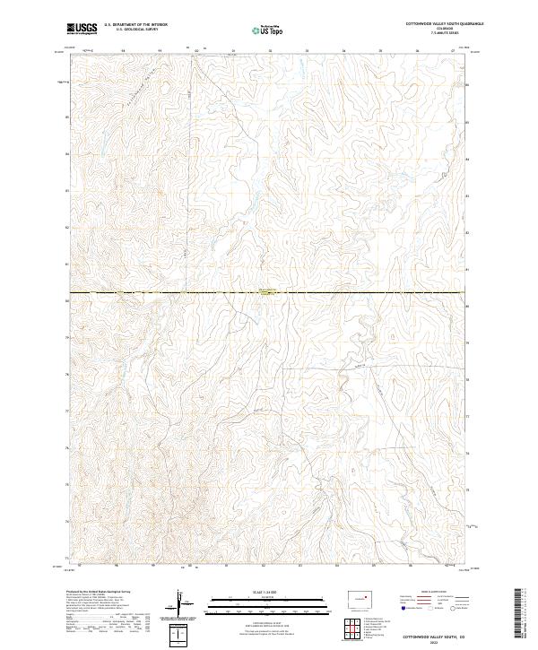
2022 Map of Cottonwood Valley South
USGS Topo · Published 2022About this map
Cottonwood Valley defines the western landscape of this Elbert County region, where the terrain is carved by the drainages of Cottonwood Cr and the extensive Rattlesnake Cr system. The map documents a sparsely populated rural area at the boundary of Arapahoe County, characterized by a geometric grid of section lines and a network of unpaved local routes. These thoroughfares, such as Rocky Rd and Ridge Rd, follow the natural contours of the high plains, providing access to remote ranching or agricultural tracts.
Find a feature on this map
16 named features on this map. Tap any name to fly to it.
Don’t see what you’re looking for? This feature index may not catch every label — zoom into the map to look around manually.
Map Details
Editions of this 2022 Cottonwood Valley South Map
This is the sole edition of this map. No revisions or reprints were ever made.
Other maps of this area

1891 · Limon
USGS Topo · 1:125,000

1892 · Limon
USGS Topo · 1:125,000

1954 · Limon
USGS Topo · 1:250,000

1957 · Limon
USGS Topo · 1:250,000

1958 · Limon
USGS Topo · 1:250,000
1969 · Noonen Reservoir SW
USGS Topo · 1:24,000
1969 · Noonen Reservoir
USGS Topo · 1:24,000

1970 · Agate
USGS Topo · 1:24,000
1970 · Barking Dog Spring
USGS Topo · 1:24,000

1970 · T Draw
USGS Topo · 1:24,000