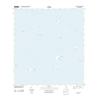
2012 Map of Cottrell Key
USGS Topo · Published 2012About this map
Cottrell Key and a scattered archipelago of mangrove islands define this aquatic landscape where the Gulf of Mexico meets the Straits of Florida. The area is characterized by shallow flats and significant underwater features like Lavina Bank, which present a complex navigational environment for those traversing the West Channel. A notable maritime route, marked simply as a Ferry Crossing, cuts across the northern and eastern portions of the map, indicating the continued importance of water-borne transit in this island chain.
Find a feature on this map
17 named features on this map. Tap any name to fly to it.
Don’t see what you’re looking for? This feature index may not catch every label — zoom into the map to look around manually.
Map Details
Editions of this 2012 Cottrell Key Map
This is the sole edition of this map. No revisions or reprints were ever made.
Other maps of this area

1921 · Key West
USGS Topo · 1:62,500

1943 · Bay Keys
USGS Topo · 1:24,000

1943 · Key West
USGS Topo · 1:24,000

1943 · Cottrell Key
USGS Topo · 1:24,000

1962 · Key West
USGS Topo · 1:24,000

1963 · Cottrell Key
USGS Topo · 1:24,000

1971 · Key West
USGS Topo · 1:24,000
1971 · Marquesas Keys East
USGS Topo · 1:24,000
1972 · Cottrell Key
USGS Topo · 1:24,000
1972 · Bay Keys
USGS Topo · 1:24,000