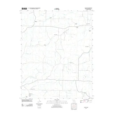
2011 Map of Couch
USGS Topo · Published 2011About this map
The tiny settlement of Couch and the historic Hy Post Office sit at the center of this rural landscape in Oregon County. The area is defined by a dense network of hollows and springs, including the curiously named Dead Dutchman Hollow and Watered Hollow. For family historians, the Blankenship Cemetery provides a specific point of genealogical interest near Midway. The map reveals a community connected by early roads and local landmarks like Hogpen Ridge and Bonds Hollow, with water sources like Eldorado Spring and Duncan Spring dotting the drainages of Frederick Creek and Janes Creek. This topographic record illustrates the persistence of small Missouri crossroads such as Corona and Jeff within a landscape shaped by narrow ridges and spring-fed creeks.
Find a feature on this map
49 named features on this map. Tap any name to fly to it.
Don’t see what you’re looking for? This feature index may not catch every label — zoom into the map to look around manually.
Map Details
Editions of this 2011 Couch Map
This is the sole edition of this map. No revisions or reprints were ever made.
Other maps of this area

1943 · Thayer
USGS Topo · 1:62,500

1944 · Couch
USGS Topo · 1:62,500

1946 · Thayer
USGS Topo · 1:62,500

1946 · Couch
USGS Topo · 1:62,500

1957 · Poplar Bluff
USGS Topo · 1:250,000

1959 · Poplar Bluff
USGS Topo · 1:250,000

1960 · Poplar Bluff
USGS Topo · 1:250,000

1962 · Mammoth Spring
USGS Topo · 1:24,000
1968 · Hardy NE
USGS Topo · 1:24,000
1968 · Wirth
USGS Topo · 1:24,000