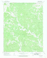
1968 Map of Hardy NE
USGS Topo · Published 1969About this map
The borderlands between Missouri and Arkansas are defined here by the steep ravines and ridges of Upper North Union and Lower North Union. In this late 1960s landscape, community life centered on remote landmarks like English Bluff Ch and Banks Ch. The terrain is deeply incised by a complex network of waterways, including Janes Creek and the Timber Fork, which separate local high points like Nubbin Ridge and Ellis Ridge. Genealogists will find a high density of family burial grounds scattered across the townships, such as James Cem, McCollough Cem, and Perry Cem. Small-scale land use is evident in the presence of a single Mine and numerous springs and ponds like Stillhouse Spring and Persimmon Pond, reflecting a rural economy tied closely to the natural hydrology of the hollows.
Find a feature on this map
52 named features on this map. Tap any name to fly to it.
Don’t see what you’re looking for? This feature index may not catch every label — zoom into the map to look around manually.
Map Details
Editions of this 1968 Hardy NE Map
2 editions found
Other maps of this area

1941 · Gatewood
USGS Topo · 1:62,500

1944 · Couch
USGS Topo · 1:62,500

1945 · Gatewood
USGS Topo · 1:62,500

1946 · Couch
USGS Topo · 1:62,500

1957 · Poplar Bluff
USGS Topo · 1:250,000

1959 · Poplar Bluff
USGS Topo · 1:250,000

1960 · Poplar Bluff
USGS Topo · 1:250,000

1966 · Ravenden Springs
USGS Topo · 1:24,000
1966 · Billmore
USGS Topo · 1:24,000

1968 · Hardy
USGS Topo · 1:24,000