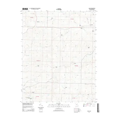
2015 Map of Couch
USGS Topo · Published 2015About this map
Couch and Midway anchor this pocket of Oregon County, where a complex network of hollows and ridges defines the Ozark landscape. The terrain is deeply inscribed with family-named landmarks and water sources, from Duncan Spring in the north to the Eldorado Spring and Ruprecht Spring system in the south. These springs once provided essential water for the scattered farmsteads and small communities like Corona and Jeff that dot the map. Local heritage is preserved at Rose Hill Cemetery and Norman Cemetery, which remain as touchstones for genealogists tracing families in this rural corridor.
Find a feature on this map
61 named features on this map. Tap any name to fly to it.
Don’t see what you’re looking for? This feature index may not catch every label — zoom into the map to look around manually.
Map Details
Editions of this 2015 Couch Map
This is the sole edition of this map. No revisions or reprints were ever made.
Other maps of this area

1943 · Thayer
USGS Topo · 1:62,500

1944 · Couch
USGS Topo · 1:62,500

1946 · Thayer
USGS Topo · 1:62,500

1946 · Couch
USGS Topo · 1:62,500

1957 · Poplar Bluff
USGS Topo · 1:250,000

1959 · Poplar Bluff
USGS Topo · 1:250,000

1960 · Poplar Bluff
USGS Topo · 1:250,000

1962 · Mammoth Spring
USGS Topo · 1:24,000
1968 · Hardy NE
USGS Topo · 1:24,000
1968 · Wirth
USGS Topo · 1:24,000