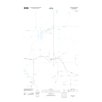
2013 Map of Couderay
USGS Topo · Published 2013About this map
Couderay River wind through the center of this Sawyer County landscape, anchoring the village of Couderay during a period of modern stability. The map reveals a region defined by its hydrography, where numerous named lakes and creeks—including Ashegon Lake, Pike Lake, and the cold waters of Eddy Creek Spring—dot the glacial terrain. To the southwest, the smaller settlement of Lemington sits near the winding course of Swift Cr, illustrating the rural distribution of homes and farmsteads along a network of fire lanes and county roads. Transportation is dictated by State Road 27 70, which parallels the river valley, connecting these isolated communities. The survey detail highlights the intricate drainage patterns of the Northwoods, from the larger Blueberry Lake in the northeast to the smaller basins like Beverly Lake and Eddy Cr Pond.
Find a feature on this map
49 named features on this map. Tap any name to fly to it.
Don’t see what you’re looking for? This feature index may not catch every label — zoom into the map to look around manually.
Map Details
Editions of this 2013 Couderay Map
This is the sole edition of this map. No revisions or reprints were ever made.
Other maps of this area

1944 · Exeland
USGS Topo · 1:48,000

1944 · Couderay
USGS Topo · 1:48,000

1944 · Radisson
USGS Topo · 1:48,000

1945 · Meteor
USGS Topo · 1:48,000

1947 · Exeland
USGS Topo · 1:48,000

1948 · Couderay
USGS Topo · 1:48,000

1949 · Radisson
USGS Topo · 1:48,000

1949 · Meteor
USGS Topo · 1:48,000

1953 · Rice Lake
USGS Topo · 1:250,000

1959 · Rice Lake
USGS Topo · 1:250,000