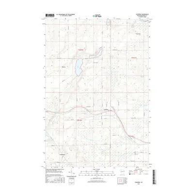
2015 Map of Couderay
USGS Topo · Published 2015About this map
The Couderay River meanders through this Sawyer County landscape, anchoring a network of glacial lakes and wetlands that define the local geography. The settlement of Couderay serves as a central hub, situated near the Eddy Cr Pond and the confluence of several small tributaries. To the north, the community of Reserve sits west of the prominent Devils Lake, while the settlement of New Post occupies the northeast corner near Blueberry Lake. This 2015 survey reveals a terrain heavily influenced by water, from the expansive Biernie Swamp to isolated water bodies like Ashegon Lake and Beverly Lake. The road network, including Resvn Hwy 4 and Co Hwy CC, connects these dispersed settlements and provides access to the Eddy Creek Spring, illustrating how the modern infrastructure navigates the natural hydrology of the region.
Find a feature on this map
54 named features on this map. Tap any name to fly to it.
Don’t see what you’re looking for? This feature index may not catch every label — zoom into the map to look around manually.
Map Details
Editions of this 2015 Couderay Map
This is the sole edition of this map. No revisions or reprints were ever made.
Other maps of this area

1944 · Exeland
USGS Topo · 1:48,000

1944 · Couderay
USGS Topo · 1:48,000

1944 · Radisson
USGS Topo · 1:48,000

1945 · Meteor
USGS Topo · 1:48,000

1947 · Exeland
USGS Topo · 1:48,000

1948 · Couderay
USGS Topo · 1:48,000

1949 · Radisson
USGS Topo · 1:48,000

1949 · Meteor
USGS Topo · 1:48,000

1953 · Rice Lake
USGS Topo · 1:250,000

1959 · Rice Lake
USGS Topo · 1:250,000