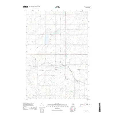
2018 Map of Couderay
USGS Topo · Published 2018About this map
Couderay River defines the lower half of this Sawyer County landscape, flowing through the namesake village of Couderay and eastward toward the Riernit Swamp. This 2018 survey reveals a modern rural structure built upon older foundations, with the settlement of Reserve positioned in the northwest and Lemington at the southern edge. The water system is particularly dense, including Ashegon Lake, Devils Lake, and Pike Lake in the north, while the Eddy Creek Spring feeds into Eddy Cr and Eddy Cr Pond. The transportation network is a mix of state and local routes like Co Hwy CC and the grid of forestry and residential roads such as Blueberry Ave and Ashegon Fire Ln. The presence of numerous named drainages like Section Twenty Cr and Surette Cr illustrates the complex hydrology of this part of northern Wisconsin.
Find a feature on this map
51 named features on this map. Tap any name to fly to it.
Don’t see what you’re looking for? This feature index may not catch every label — zoom into the map to look around manually.
Map Details
Editions of this 2018 Couderay Map
This is the sole edition of this map. No revisions or reprints were ever made.
Other maps of this area

1944 · Exeland
USGS Topo · 1:48,000

1944 · Couderay
USGS Topo · 1:48,000

1944 · Radisson
USGS Topo · 1:48,000

1945 · Meteor
USGS Topo · 1:48,000

1947 · Exeland
USGS Topo · 1:48,000

1948 · Couderay
USGS Topo · 1:48,000

1949 · Radisson
USGS Topo · 1:48,000

1949 · Meteor
USGS Topo · 1:48,000

1953 · Rice Lake
USGS Topo · 1:250,000

1959 · Rice Lake
USGS Topo · 1:250,000