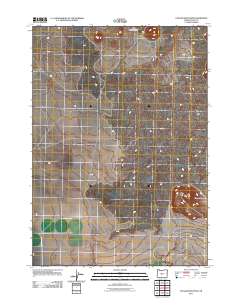
2011 Map of Cougar Mountain
USGS Topo · Published 2011About this map
The Devils Garden occupies the northern reaches of this high-desert landscape in Lake County, where lava flows and volcanic formations dictate the character of the terrain. The map captures a largely uninhabited and primitive expanse at the start of the twenty-first century, defined by its geological features rather than human settlement. In the southeast, Cougar Mountain rises as a prominent landmark, overlooking a network of unpaved tracks and local access routes. Civil infrastructure is limited to the intersection of County Hwy-5 11B and County Hwy-5 11C, which serve as the primary conduits through this section of the Oregon high desert. The sparse distribution of man-made features reflects the area's isolation and its primary role as a landscape of natural study and geological interest.
Find a feature on this map
4 named features on this map. Tap any name to fly to it.
Don’t see what you’re looking for? This feature index may not catch every label — zoom into the map to look around manually.
Map Details
Editions of this 2011 Cougar Mountain Map
This is the sole edition of this map. No revisions or reprints were ever made.
Other maps of this area

1931 · Newberry Crater
USGS Topo · 1:125,000

1935 · Newberry Crater
USGS Topo · 1:125,000

1955 · Crescent
USGS Topo · 1:250,000

1957 · Crescent
USGS Topo · 1:250,000

1958 · Crescent
USGS Topo · 1:250,000

1970 · Crescent
USGS Topo · 1:250,000

1979 · Crescent
USGS Topo · 1:100,000

1981 · Fox Butte
USGS Topo · 1:24,000

1981 · Hogback Butte
USGS Topo · 1:24,000

1981 · Cougar Mtn
USGS Topo · 1:24,000