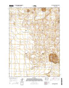
2014 Map of Cougar Mountain
USGS Topo · Published 2014About this map
Cougar Mountain rises as a prominent landmark above the surrounding high desert floor in the southeastern portion of this survey. The terrain is defined by the volcanic textures of The Devils Garden, a basaltic lava field that stretches across the northern half of the quadrangle. Transport through this arid landscape is limited to a network of established routes like Cabin Lk and Webster Rd, which connect the remote sections of Fort Rock Valley. Local points of interest include Derrick Cave and the winding path of Devils Gdn road. This record documents the Public Land Survey System grid across Townships 24 and 25 South, illustrating how the natural features of the Oregon interior dictated the placement of early range roads and land boundaries.
Find a feature on this map
14 named features on this map. Tap any name to fly to it.
Don’t see what you’re looking for? This feature index may not catch every label — zoom into the map to look around manually.
Map Details
Editions of this 2014 Cougar Mountain Map
This is the sole edition of this map. No revisions or reprints were ever made.
Other maps of this area

1931 · Newberry Crater
USGS Topo · 1:125,000

1935 · Newberry Crater
USGS Topo · 1:125,000

1955 · Crescent
USGS Topo · 1:250,000

1957 · Crescent
USGS Topo · 1:250,000

1958 · Crescent
USGS Topo · 1:250,000

1970 · Crescent
USGS Topo · 1:250,000

1979 · Crescent
USGS Topo · 1:100,000

1981 · Fox Butte
USGS Topo · 1:24,000

1981 · Hogback Butte
USGS Topo · 1:24,000

1981 · Cougar Mtn
USGS Topo · 1:24,000