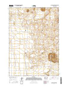
2017 Map of Cougar Mountain
USGS Topo · Published 2017About this map
Fort Rock Valley dominates the southern reaches of this landscape in Lake County, Oregon. The terrain is defined by the prominent elevation of Cougar Mtn in the southeast and the distinctive volcanic features of The Devils Garden to the north. This 2017 survey illustrates a high-desert environment where human infrastructure is sparse, limited primarily to a grid of rural access routes like Webster Rd, Soto Rd, and Soto W. The map documents the precise Public Land Survey System divisions across Townships 24 and 25 South, capturing a moment in time before further shifts in land use or nomenclature. These surveyed lines provide a essential framework for understanding property boundaries and access in this expansive section of the Oregon interior.
Find a feature on this map
11 named features on this map. Tap any name to fly to it.
Don’t see what you’re looking for? This feature index may not catch every label — zoom into the map to look around manually.
Map Details
Editions of this 2017 Cougar Mountain Map
This is the sole edition of this map. No revisions or reprints were ever made.
Other maps of this area

1931 · Newberry Crater
USGS Topo · 1:125,000

1935 · Newberry Crater
USGS Topo · 1:125,000

1955 · Crescent
USGS Topo · 1:250,000

1957 · Crescent
USGS Topo · 1:250,000

1958 · Crescent
USGS Topo · 1:250,000

1970 · Crescent
USGS Topo · 1:250,000

1979 · Crescent
USGS Topo · 1:100,000

1981 · Fox Butte
USGS Topo · 1:24,000

1981 · Hogback Butte
USGS Topo · 1:24,000

1981 · Cougar Mtn
USGS Topo · 1:24,000