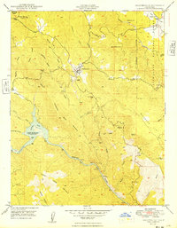
1949 Map of Coulterville
USGS Topo · Published 1949About this map
Coulterville sits at the heart of this post-war survey, a historic mining community where the Gold Rush legacy is still visible in the landscape. The map records the local mining economy through sites like the Mary Harrison Mine and the Gold Coin Mine, while the Virginia Mine (Aban'd) points to the passing of the era. The terrain is marked by steep ridges and deep gulches, with the Merced River flowing through the southern half of the quadrangle. Significant water management and transportation history is evident at Lake McClure (Exchequer Res) and the site of the Split Rock Ferry (Aban'd). To the northeast, the Stanislaus National Forest boundary borders Greeley Hill, where the Greeley Sch served the local families of the foothills.
Find a feature on this map
44 named features on this map. Tap any name to fly to it.
Don’t see what you’re looking for? This feature index may not catch every label — zoom into the map to look around manually.
Map Details
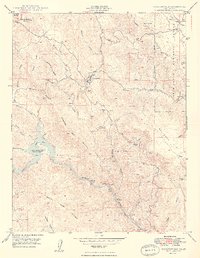
Editions of this 1949 Coulterville Map
2 editions found
Other maps of this area

1893 · Sonora
USGS Topo · 1:125,000

1896 · Sonora
USGS Topo · 1:125,000

1897 · Sonora
USGS Topo · 1:125,000

1898 · Sonora
USGS Topo · 1:125,000

1916 · Merced Falls
USGS Topo · 1:24,000

1919 · Merced Falls
USGS Topo · 1:31,680

1944 · Merced Falls
USGS Topo · 1:62,500

1947 · San Jose
USGS Topo · 1:250,000

1947 · Coulterville
USGS Topo · 1:62,500
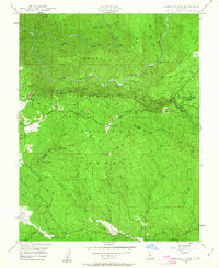
1947 · Jawbone Ridge
USGS Topo · 1:24,000