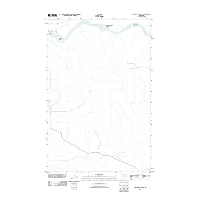
2011 Map of Council Island
USGS Topo · Published 2011About this map
The Missouri River carves a deep path through Chouteau County on this 2011 survey, a landscape defined by the shifting braids and islands of the river corridor. This stretch of the water is marked by several significant landforms within the channel, including Council Island, the Holmes Council Islands, and the Iron City Islands. These river features have long served as navigational waypoints in this relatively unpopulated region. Transportation across the water is anchored by two distinct crossings: the modern Winifred Bridge and the Lohse PN Ferry, representing both contemporary and traditional river transit. Away from the main river valley, the topography is dominated by the winding drainage of Dog Creek, which meanders through the arid uplands to join the Missouri, while Birch Cr enters the system from the north. The map documents a landscape where the river remains the primary geographic and structural element.
Find a feature on this map
8 named features on this map. Tap any name to fly to it.
Don’t see what you’re looking for? This feature index may not catch every label — zoom into the map to look around manually.
Map Details
Editions of this 2011 Council Island Map
This is the sole edition of this map. No revisions or reprints were ever made.
Other maps of this area

1954 · P N Ranch
USGS Topo · 1:24,000

1954 · Gallatin Rapids
USGS Topo · 1:24,000

1954 · Council Island
USGS Topo · 1:24,000

1954 · Lewistown
USGS Topo · 1:250,000

1959 · Lewistown
USGS Topo · 1:250,000

1964 · Wolf Creek Falls
USGS Topo · 1:24,000

1964 · Pigtail Coulee
USGS Topo · 1:24,000

1964 · Anderson Bridge
USGS Topo · 1:24,000

1964 · Ragland Bench
USGS Topo · 1:24,000

1964 · Chase Hill
USGS Topo · 1:24,000