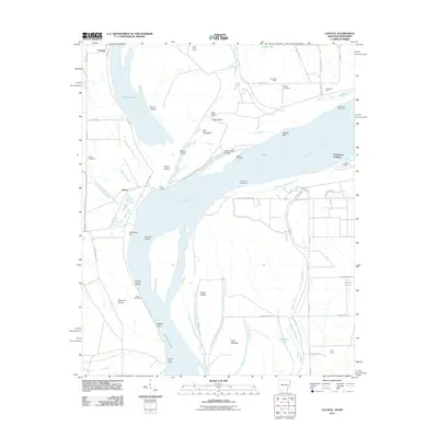
2011 Map of Council
USGS Topo · Published 2011About this map
Council Island and the shifting channels of the Mississippi River dominate this landscape along the Arkansas-Mississippi border. The survey details a river-dependent economy marked by numerous landings and revetments, including Peters Landing and Commerce Landing, which served the surrounding agricultural tracts. Family-named farms such as Blue Point Farm, Anderson Farm, and Perry Farm are scattered across the floodplain, often situated near relic water bodies like Midway Lake and Old River Lake. Further inland, the small settlement of Peters is anchored by Peters Cemetery, while Happy Cemetery lies to the northeast. The presence of Ashley Point Lodge and various bars and towheads like Mac Towhead reflects the active use of the river for both commerce and recreation in the early 21st century.
Find a feature on this map
53 named features on this map. Tap any name to fly to it.
Don’t see what you’re looking for? This feature index may not catch every label — zoom into the map to look around manually.
Map Details
Editions of this 2011 Council Map
This is the sole edition of this map. No revisions or reprints were ever made.
Other maps of this area

1908 · Hollywood
USGS Topo · 1:24,000

1913 · Hollywood
USGS Topo · 1:31,680

1931 · Horseshoe Lake
USGS Topo · 1:62,500

1939 · Clayton
USGS Topo · 1:62,500

1939 · Horseshoe Lake
USGS Topo · 1:62,500

1939 · Park Place
USGS Topo · 1:62,500

1939 · Latour
USGS Topo · 1:62,500

1948 · Helena
USGS Topo · 1:250,000

1950 · Helena
USGS Topo · 1:250,000

1954 · Horseshoe Lake
USGS Topo · 1:62,500