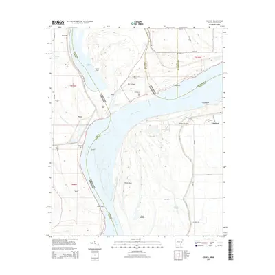
2014 Map of Council
USGS Topo · Published 2014About this map
Council and Peters anchor the western bank of the Mississippi River on this 2014 survey, where the shifting river channel creates a complex landscape of islands, bars, and cutoffs across the Arkansas and Mississippi state line. The map illustrates how the river's historical movements have shaped the geography, leaving behind features like Council Island and Mac Towhead while defining modern boundaries between Lee, Tunica, and Crittenden counties. On the eastern shore, the transition into Mississippi is marked by the developed area of Tunica Resorts and the riverside community of Commerce.
Find a feature on this map
49 named features on this map. Tap any name to fly to it.
Don’t see what you’re looking for? This feature index may not catch every label — zoom into the map to look around manually.
Map Details
Editions of this 2014 Council Map
This is the sole edition of this map. No revisions or reprints were ever made.
Other maps of this area

1908 · Hollywood
USGS Topo · 1:24,000

1913 · Hollywood
USGS Topo · 1:31,680

1931 · Horseshoe Lake
USGS Topo · 1:62,500

1939 · Clayton
USGS Topo · 1:62,500

1939 · Horseshoe Lake
USGS Topo · 1:62,500

1939 · Park Place
USGS Topo · 1:62,500

1939 · Latour
USGS Topo · 1:62,500

1948 · Helena
USGS Topo · 1:250,000

1950 · Helena
USGS Topo · 1:250,000

1954 · Horseshoe Lake
USGS Topo · 1:62,500