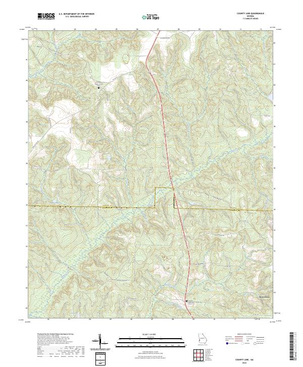
2024 Map of County Line
USGS Topo · Published 2024About this map
Benevolence sits at the southern edge of this West Georgia landscape, where the border between Stewart and Randolph counties is defined by a series of high ridges and deep creek drainages. The area is characterized by a network of rural roads and watercourses that supported small-scale agriculture and community life into the early 21st century. Significant local genealogy landmarks include the Philadelphia Baptist Church and its associated cemetery in the north, alongside the Pumpkin Creek Road Church and Pumpkin Creek Road Church Cem further south.
Find a feature on this map
42 named features on this map. Tap any name to fly to it.
Don’t see what you’re looking for? This feature index may not catch every label — zoom into the map to look around manually.
Map Details
Editions of this 2024 County Line Map
This is the sole edition of this map. No revisions or reprints were ever made.
Other maps of this area

1950 · Lumpkin
USGS Topo · 1:24,000

1950 · Lumpkin SW
USGS Topo · 1:24,000

1950 · Lumpkin
USGS Topo · 1:62,500

1953 · Dothan
USGS Topo · 1:250,000

1954 · Dothan
USGS Topo · 1:250,000

1955 · Dothan
USGS Topo · 1:250,000

1955 · Lumpkin
USGS Topo · 1:24,000

1955 · Lumpkin SW
USGS Topo · 1:24,000

1955 · Lumpkin
USGS Topo · 1:62,500

1955 · Phenix City
USGS Topo · 1:250,000